News
Show me:
In-car speed limit warning tech fails to read road signs 25% of the time
In-car speed limit warning tech fails to read road signs 25% of the time
A new study by Thatcham Research found the MG ZS displays the wrong speed limit one in four times
Car Deal of the Day: Embrace the heatwave with a drop-top Mazda MX-5 for £222 a month
Car Deal of the Day: Embrace the heatwave with a drop-top Mazda MX-5 for £222 a month
Two-seat sports cars don’t come any better than the Mazda MX-5, especially at this price. It’s our Deal of the Day for 24 June
I drove the Honda Super-N and it puts bigger EVs to shame
I drove the Honda Super-N and it puts bigger EVs to shame
Richard Ingram thinks Honda's Super-N is the biggest car-related curveball in 2026 so far.
Sitting is overrated, new Sanrivatti hypercar reinvents the way you drive
Sitting is overrated, new Sanrivatti hypercar reinvents the way you drive
New outfit Sanrivatti wants to build a hypercar that makes you feel like you’re riding a superbike
New Skoda Peaq electric 7-seat SUV arrives making a strong case to families
New Skoda Peaq electric 7-seat SUV arrives making a strong case to families
The most spacious and luxurious Skoda ever offers 390 miles of range
VW ID. Buzz gets new Good-Night package for camper van capability
VW ID. Buzz gets new Good-Night package for camper van capability
We’ve been waiting for VW to transform the ID. Buzz into a modern camper
New Mercedes-AMG CLE 63 and its mighty V8 spotted for the first time
New Mercedes-AMG CLE 63 and its mighty V8 spotted for the first time
Latest pictures show off hot CLE’s new engine and latest design tweaks
Best car manufacturers 2026
Best car manufacturers 2026
Thousands of UK drivers share their real-world verdicts on the manufacturers of the cars they own
Skoda’s new BMW rival revealed in this week’s Auto Express
Skoda’s new BMW rival revealed in this week’s Auto Express
In Auto Express magazine this week we have the lowdown on the new Skoda Peaq and drive the Honda Super-N
New Morgan Midsummer Coupe is as rare as it is expensive... very
New Morgan Midsummer Coupe is as rare as it is expensive... very
New Midsummer Coupe is the first fixed-roof Morgan since the Aero Coupe
Four new Land Rover Defender Classic V8s with wild colour-changing paint go to one customer
Four new Land Rover Defender Classic V8s with wild colour-changing paint go to one customer
You’re not likely to see these special Land Rover Defenders doing work around the farm anytime soon
No electric Porsche 911: brand confirms future plans that omit EV flagship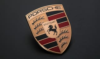
No electric Porsche 911: brand confirms future plans that omit EV flagship
AGM mentioned a slimming of the Porsche portfolio and no mention of electric Cayman or Boxster
Car Deal of the Day: Geely Starray at £198 a month is astronomical value
Car Deal of the Day: Geely Starray at £198 a month is astronomical value
Geely is trying hard to make an impression on Brits with its very affordable Starray SUV. It’s our Deal of the Day for 23 June.
Major Audi A3 updates and price cut are part of second facelift in two years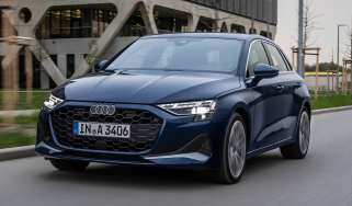
Major Audi A3 updates and price cut are part of second facelift in two years
The new Audi A3 will be available from September, with a choice of petrol, diesel or plug-in hybrid power, as well as sportier S3 and RS 3 editions
New Jaguar Type 01: October reveal confirmed for world’s hottest new car
New Jaguar Type 01: October reveal confirmed for world’s hottest new car
The controversial new era of Jaguar will begin with the Type 01, and its big unveiling is scheduled for the autumn
Electric Nissan Qashqai axed say reports: British-built EV victim of cost-cutting drive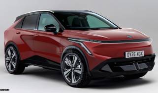
Electric Nissan Qashqai axed say reports: British-built EV victim of cost-cutting drive
The zero-emissions version of Nissan’s best-selling SUV was expected to arrive soon, and would have been built at the brand’s Sunderland plant
Car Deal of the Day: Plug-in with the popular Ford Puma Gen-E for just £196 a month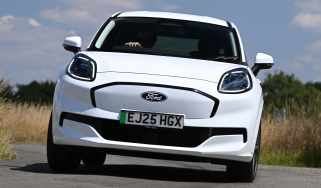
Car Deal of the Day: Plug-in with the popular Ford Puma Gen-E for just £196 a month
Fun to drive and efficient, the Ford Puma Gen-E is an excellent electric hatchback. It’s our Deal of the Day for 22 June.
New BYD Shark pick-up aims to take a bite out of Ford Ranger sales
New BYD Shark pick-up aims to take a bite out of Ford Ranger sales
The hi-tech hybrid pick-up truck will make its UK debut at the 2026 Goodwood Festival of Speed
New BMW iM3 to be the most powerful M3 ever, but keep the classic M-car feel
New BMW iM3 to be the most powerful M3 ever, but keep the classic M-car feel
The first-ever electric M3 is due to arrive next year, featuring a quad-motor powertrain capable of delivering upwards of 1,300bhp, but BMW is likely …
The EV pay-per-mile tax is looming, but now is still the time to buy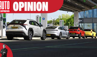
The EV pay-per-mile tax is looming, but now is still the time to buy
Consumer reporter Tom Jervis explains why now is the ideal time to embark on EV ownership
New Smart #2: first look inside fun ‘n’ funky ForTwo replacement
New Smart #2: first look inside fun ‘n’ funky ForTwo replacement
The successor to the iconic Smart ForTwo is designed to thrive in the city, but should be capable on the open road, too
New Renault Megane facelift: 310-mile range, sportier looks and MagSafe
New Renault Megane facelift: 310-mile range, sportier looks and MagSafe
Mid-life update for Renault’s electric family hatch brings a bigger LFP battery and refreshed styling
New Hyundai i20 N hot hatch will get aggressive looks and hybrid power
New Hyundai i20 N hot hatch will get aggressive looks and hybrid power
The Koreans are determined to revive the affordable hot hatch, so brace yourself for the hybrid i20 N
Hyundai has hammered another nail into the estate car coffin
Hyundai has hammered another nail into the estate car coffin
The Hyundai estate car is dead, with no plans for the brand to start producing new wagons in the future
New Hyundai i20: bigger and bolder supermini will be tweaked for Europe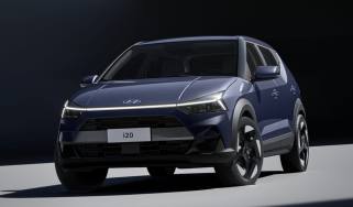
New Hyundai i20: bigger and bolder supermini will be tweaked for Europe
The new Hyundai i20 has been revealed in Brazil, but will get a cosmetic makeover before it comes to Europe
Car Deal of the Day: Hyundai Santa Fe PHEV is a 7-seater steal at £295 per month
Car Deal of the Day: Hyundai Santa Fe PHEV is a 7-seater steal at £295 per month
The Santa Fe PHEV is an unmistakable presence with great practicality and fuel efficiency, making it an ideal Deal of the Day for 21 June.
Buying a new car? I bet you don’t know where it was built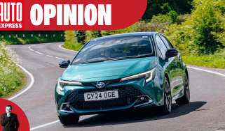
Buying a new car? I bet you don’t know where it was built
Mike Rutherford thinks car manufacturers should adopt supermarket-style country-of-origin labelling so buyers know exactly where cars have been built.
Car Deal of the Day: charming yet rugged Jeep Avenger for just £182 per month
Car Deal of the Day: charming yet rugged Jeep Avenger for just £182 per month
Jeep’s baby SUV offers 4x4-esque looks and affordable running costs, especially with our Deal of the Day for 20 June
Renault 5 and Renault 4 could get even cheaper thanks to Twingo’s battery tech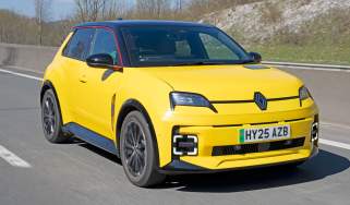
Renault 5 and Renault 4 could get even cheaper thanks to Twingo’s battery tech
The Renault 5 and Renault 4 will eventually get LFP tech to help make them even more accessible
Car Deal of the Day: Changan Deepal S07 is a great-looking SUV for under £230 a month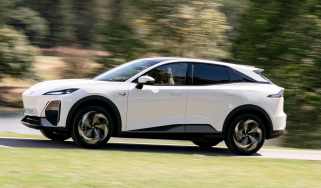
Car Deal of the Day: Changan Deepal S07 is a great-looking SUV for under £230 a month
Italian designed and tuned in Britain, the Changan Deepal S07 is very reasonably priced. It’s our Deal of the Day for 19 June.
New Alpine A110 EV set for Goodwood Festival of Speed debut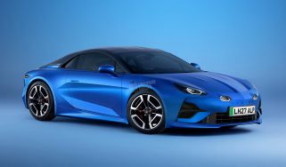
New Alpine A110 EV set for Goodwood Festival of Speed debut
France’s alternative to the Porsche Cayman is about to go electric, and UK fans will be first to see it
Lepas L8 kicks off from £34,900 with Jaecoo’s plug-in hybrid power
Lepas L8 kicks off from £34,900 with Jaecoo’s plug-in hybrid power
After Jaecoo, Omoda and Chery, is the new Lepas L8 too late to make an impact on the UK market?
New BMW i3 on sale now: electric 3 Series finally ready to take on Tesla Model 3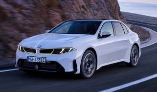
New BMW i3 on sale now: electric 3 Series finally ready to take on Tesla Model 3
Are you watching Tesla, Polestar, Audi and Mercedes? The new BMW i3 is here setting new standards with its huge 563-mile range
New ‘baby’ Range Rover: Velar replacement to get electric and hybrid power
New ‘baby’ Range Rover: Velar replacement to get electric and hybrid power
JLR is getting ready to unveil a mid-size Range Rover and our exclusive images preview how it could look
This Koenigsegg Sadair’s Spear is a Lego Technic fan’s 4,000-piece dream
This Koenigsegg Sadair’s Spear is a Lego Technic fan’s 4,000-piece dream
Lego has launched the latest model in its Technic Ultimate Car Concept Series - the Koenigsegg Sadair’s Spear